
Topographic cartography

Topographical maps are detailed geographical maps with their content, design and mathematical basis, on which different objects (natural and socio-economic objects), their unique quantitative and qualitative characteristics, as well as location features are depicted.
Since 2009, the topographic maps updating works of the RA state scale has started.
1700 km2 are in 2009, 3600 km2 in 2010, 2750 km2 in 2011, and 2915 km2 in 2012 were renewed.
Orthophoto images were also created on the mentioned areas. In 2013, 2440 km2 area was renewed in Shirak, Lori and Tavush Regions. In 2014, the topographic maps of the RA state scale were updated, in Shirak and Lori Regions of RA 1233.69 km2 area was updated.
These works are of a continuous, and monitoring will be done on the basis of space photography materials carried out every year, the results of which will reveal and update the topographic maps of the RA state scale series that have undergone noticeable changes due to various circumstances.
In 2014 and 2021, aerial photography works were carried out for Yerevan, Gyumri and Vanadzor with a resolution of 10 cm.
In 2015, on the basis of aerial photos, the creation of topographic plans of Vanadzor, Gyumri and Spitak in 2016, and Vagharshapat in 2019 on a scale of 1:2000 of 4328.6 km2 area was completed.
The aerial photography carried out in 2014 and 2021 in the basis for digitization of the base layers of topographic maps. The specified base layers will be included in the National Spatial Data Infrastructure.
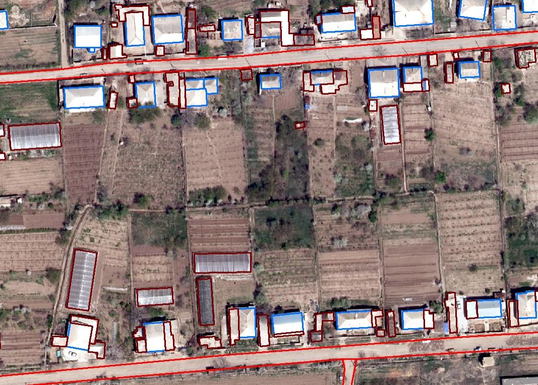
Fig. 1. Digitization of buildings
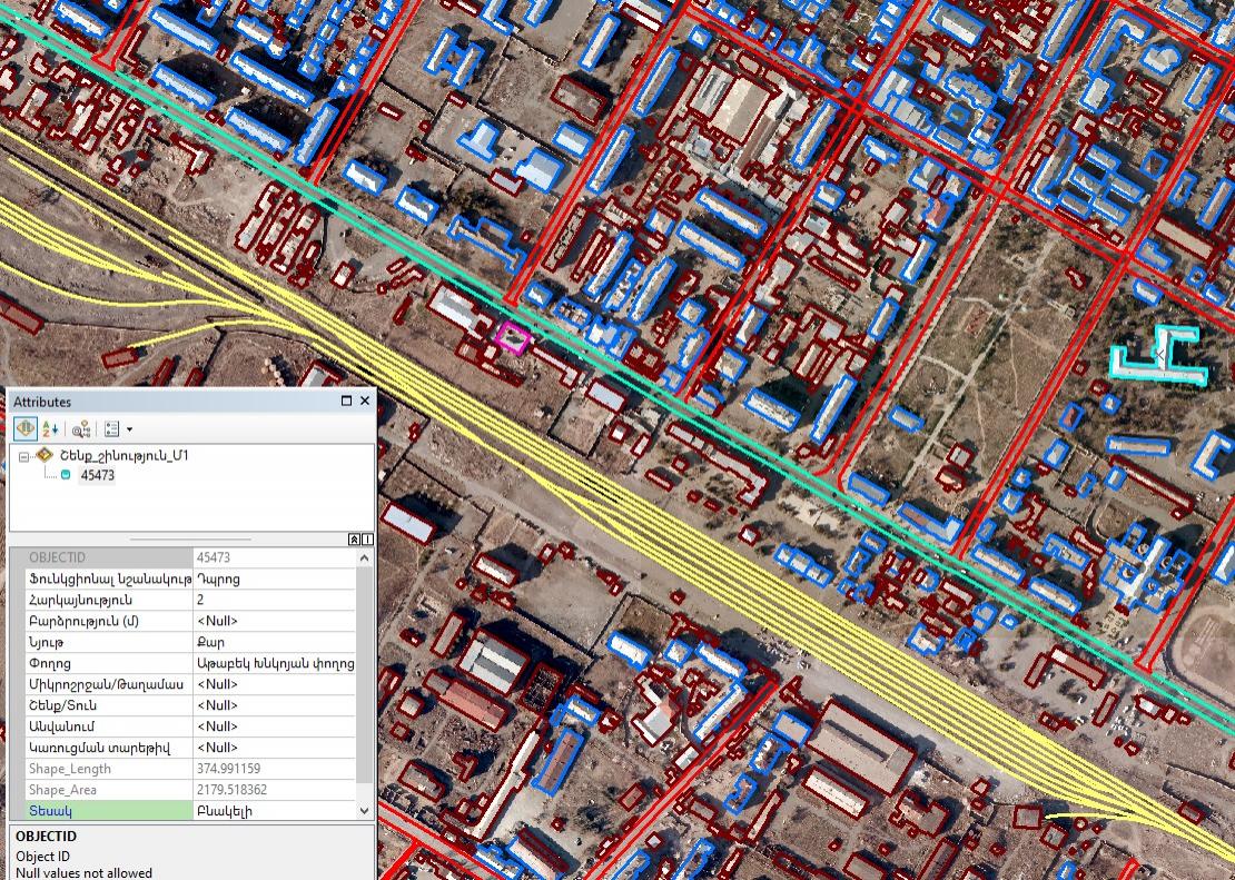
Fig. 2 Digitization of base layers with corresponding attribute table